
Reseach – Rainfall Runoff Modelling Using HEC-HMS with Satelite Data
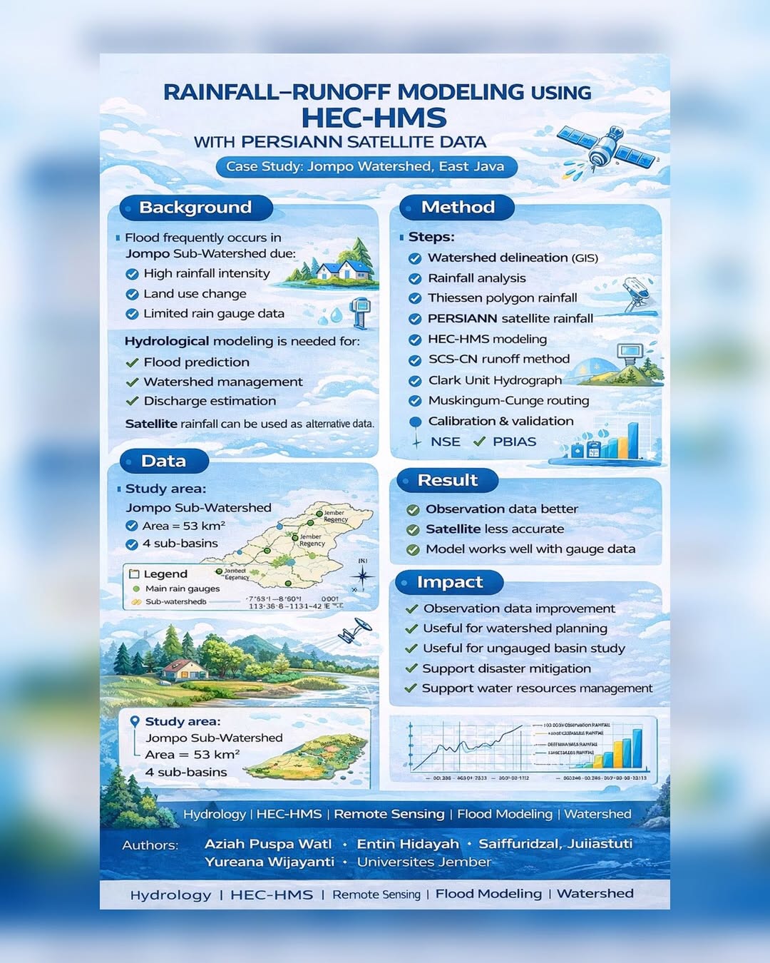
Flood events in the Jompo Sub-Watershed, East Java, are driven by high rainfall intensity, land use change, and limited rain gauge data — making reliable hydrological modeling a critical need. This research models rainfall-runoff using HEC-HMS combined with PERSIANN satellite rainfall data, applying GIS-based watershed delineation, SCS-CN runoff method, Clark Unit Hydrograph, and Muskingum-Cunge routing across 4 sub-basins covering 53 km². Results show that observation (gauge) data outperforms satellite data in model accuracy — yet the framework remains valuable for ungauged basin studies, watershed planning, and disaster mitigation support.
Comments :