
Research – Dam Failure and Hazard Mapping
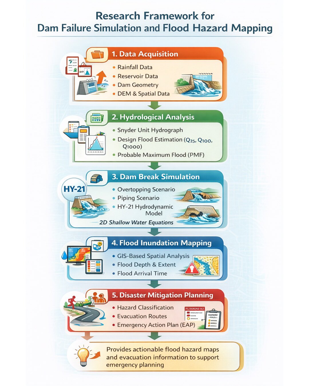
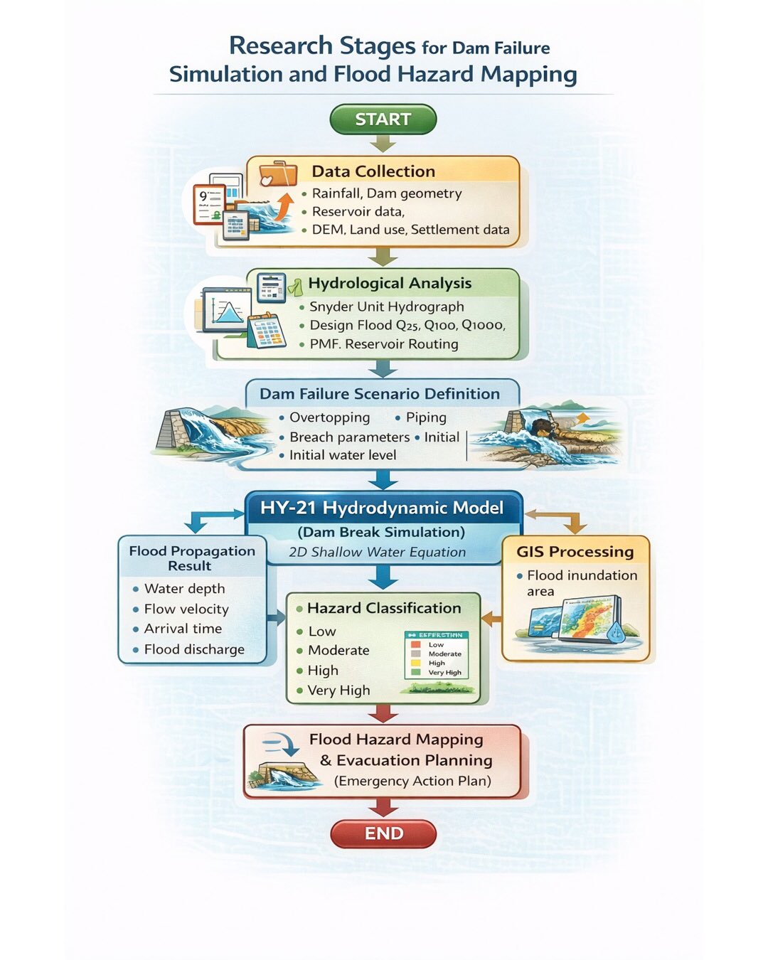
This research presents a comprehensive framework for dam failure simulation and flood hazard mapping — from data acquisition and hydrological analysis to HY-21 hydrodynamic modeling, flood inundation mapping, and disaster mitigation planning. Using 2D Shallow Water Equations and GIS-based spatial analysis, the study produces actionable flood hazard maps and evacuation plans to support emergency.
 |
 |
Comments :